Sailing Ships and Sea Monsters
Our collection contains a wealth of intriguing images that reflect the cultures and preoccupations of the mapmakers who created them. Some of the earliest, and most iconic, are those of sailing ships and sea monsters. Both are the stuff of legendary fictional maps that have entered the popular narrative through books and film. But while fiction may exaggerate, these 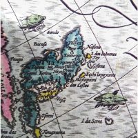 depictions are based on very real images found in very real maps and views.
There be dragons
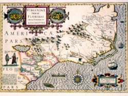
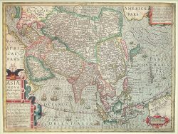
Sea monsters were prevalent in 16th and 17th-century maps of places far away from the mapmakers homeland in (primarily) western Europe. In 1606 the Flemish cartographer Jodocus Hondius re-worked and updated an earlier map of Asia by the influential Flemish cosmographer Gerardus Mercator. Neither man had ever traveled to that part of the world but sailors' tales of enormous fish made their way into their maps, perhaps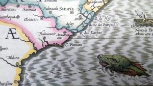 to show how "other" that part of the world was and heroic were the ship captains who dared to sail in those treacherous waters. Hondius's map of the colonies of Virginia and Florida from that same year is equally filled with sea monsters, which suggests the power of European states to dominate the seas despite the danger they presented.
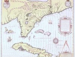
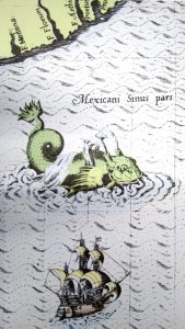 It wasn't only the Flemish who decorated their maps in this fashion, although they were master mapmakers who dominated the field. The French artist Jacques LeMoyne included huge sea monsters in his 1564 map of Florida and the Caribbean, dwarfing a nearby sailing ship.
Exploration and Discovery
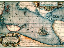
The 16th and 17th-century depictions of sailing ships also project dominance, as seen in Abraham Ortelius's magnificent map of the Pacific Ocean, dated 1589. He highlights Magellan's ship Victoria - the first to 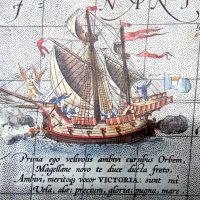 circumnavigate the world - as it sails to an oversized New Guinea.
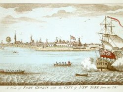
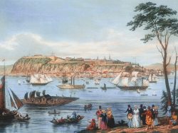
Britain's military might is shown in the early 18th-century view by I. Carnitham of Fort George, located on the tip of Manhattan in New York. Dated about 1736 a British warship in the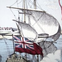 foreground thunders a salute and proudly flies the flag. And the era of the sailing ship was on the decline, overtaken by steamboats and rail, when Quebec was depicted by Capt. B. Beaufoy in this 1844 panorama. A three-masted ship
 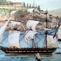 with billowing sails jostles for room in Quebec's busy harbor.
These six images represent some of the seafaring details found in our earliest maps. We hope you find them historically interesting and artistically compelling.
Showing all 6 results
-
American Southeast 1606 – Souvenir Series
$16.00 Add to cart -
Asia 1606 – Souvenir Series
$16.00 Add to cart -
Florida, Cuba, and the Bahamas 1564 – Souvenir Series
$16.00 Add to cart -
New York 1736 – Souvenir Series
$16.00 Add to cart -
Pacific Ocean 1589 – Souvenir Series
$16.00 Add to cart -
Quebec 1844 – Souvenir Series
$16.00 Add to cart