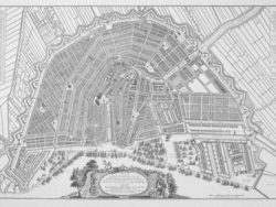
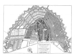
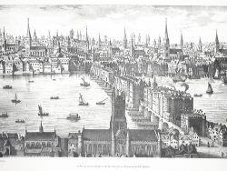
Amsterdam 1670

$32.50
The first phase of Amsterdam’s expansion in the seventeenth century began in 1610 with the development of three ring canals. This engraving by the great Dutch cartographer, Nicholas Visscher, was published about 1670. It shows the start of the second stage of development which extended the ring canal pattern around the medieval city.
Size: 19 1/4 x 22 1/2 inches. Black & White, Cover-stock Paper