New England 1780 – Souvenir Series

$20.00
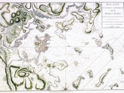
Hundreds of towns are identified on this lovely map of New England and the Hudson River Valley. First published in 1765 and revised several times, this version is the first to show Vermont as a separate state. An insert of Boston Harbor with the nearby towns picked out in red adds to its beauty.
Size: 14 1/4 x 17 1/3 inches – Color, Text-Weight paper
You may also like…
-
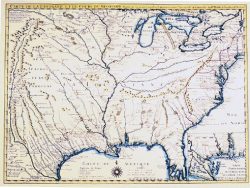
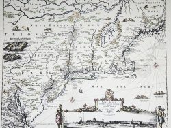
Colonial America 1718 – Souvenir Series
$20.00 Add to cart -
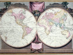
East and West Hemispheres 1808 – Souvenir Series
$20.00 Add to cart -
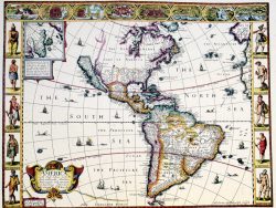
Western Hemisphere 1626 – Souvenir Series
$20.00 Add to cart -
New France 1719 – Souvenir Series
$20.00 Add to cart -
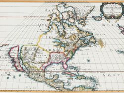
North America 1650 – Souvenir Series
$20.00 Add to cart -
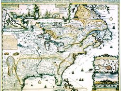
New York and New England 1685 – Souvenir Series
$20.00 Add to cart -
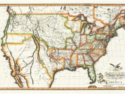
United States 1820 – Souvenir Series
$20.00 Add to cart -
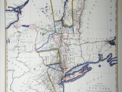
New York and New Jersey 1776
$47.50 Add to cart