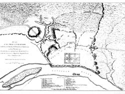
South Carolina and Georgia 1754

$55.00
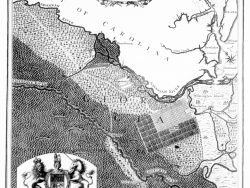
William De Brahm’s seminal map of South Carolina and George engraved by Thomas Jeffreys in London, is both extremely rare and influential. It was the first scientific survey of the southeastern coast, its islands and rivers, and identifies proprietors, parishes, forts, churches, roads and more. Lands containing swamps, marshes, and forests are also shown. “Charles Town” (Charleston”, Savannah, New Ebenezer, and other early settlements are depicted.
De Brahm, a German engineer who immigrated to America in the 1750s, relied upon the work of earlier cartographers to a certain degree but traveled extensively over the territory to compile the information needed for this large, informative map. A special feature is the highly detailed cartouche, illustrated with local flora and showing enslaved people producing South Carolina’s leading export at the time, indigo.
Originally published on four sheets, our version joins them in a single sheet for ease of handling and framing. The original is from the Collection of the Museum of Early Southern Decorative Arts at Old Salem Museums and Gardens.
Size: 21 x 22 1/2 inches. Color, Cover-stock Paper
You may also like…
-
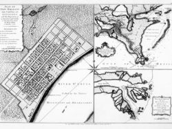
Savannah 1735
$32.50 Add to cart -
Margravate of Azilia [Georgia] 1717
$32.50 Add to cart -
Savannah 1734 – Museum Series
$35.00 Add to cart -
Georgia, Gulf Coast and Lower Mississippi 1748 – Souvenir Series
$16.00 Add to cart -
Savannah 1779
$35.00 Add to cart -
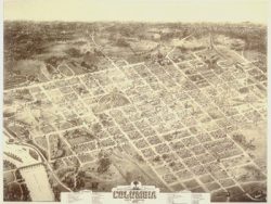
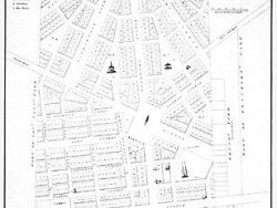
Columbia, South Carolina 1872
$40.00 Add to cart -
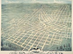
Atlanta, Georgia 1871 – Souvenir Series
$16.00 Add to cart