Southern United States 1817 – Souvenir Series

$16.00
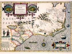
Published in Edinburgh in 1817 as part of John Thomson’s New General Atlas, this is one of two maps showing the American South and North. It is highly detailed and locates hundreds of towns and cities. Georgia is depicted as extending to the Mississippi River and the tribes and villages of many indigenous peoples are identified.
Size: 15 1/4 x 18 1/4 inches. Color, Text-Weight paper
You may also like…
-
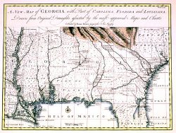
Georgia, Gulf Coast and Lower Mississippi 1748 – Souvenir Series
$16.00 Add to cart -
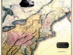
Northern United States 1817 – Souvenir Series
$16.00 Add to cart -
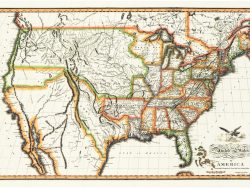
United States 1820 – Souvenir Series
$16.00 Add to cart -
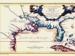
French Louisiana 1705 – Souvenir Series
$16.00 Add to cart -
American Southeast 1606 – Souvenir Series
$16.00 Add to cart