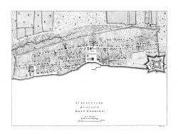
St. Augustine, Florida 1764 – Museum Series

$37.50
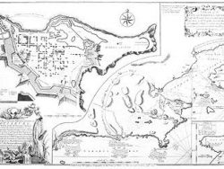
Engraved about 1764 from a survey by Don Juan de Solis, this extremely rare plan from the Library of Congress may have been the source for the similar but smaller plan dated 1763 but published in 1766. This version in full color includes an elaborate cartouche and an inset map of Florida with many place names and showing the road from St. Augustine westward to Apalachee Bay.
The museum quality edition of this view is printed on a heavy paper to highlight its delicate coloring.
Size: 14 1/4 x 18 1/4 inches. Color, Cover-stock Paper
You may also like…
-

St. Augustine, Florida 1671
$32.50 Add to cart -

Key West, Florida 1855 – Museum Series
$35.00 Add to cart -
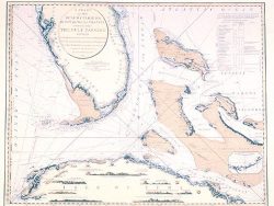
Florida, Cuba, and the Bahamas 1794 – Souvenir Series
$16.00 Add to cart -
St. Augustine, Florida 1763
$32.50 Add to cart -

St. Augustine, Florida 1599
$32.50 Add to cart -
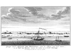
Pensacola, Florida 1743
$32.50 Add to cart -
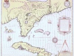
Florida, Cuba, and the Bahamas 1564 – Souvenir Series
$16.00 Add to cart