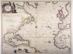
Florida, Cuba, and the Bahamas 1794 – Souvenir Series

$16.00
This splendidly detailed sailing chart was issued by William Faden in London to record the surveys by Charles Roberts and George Gauld. It is one of the earliest printed maps to show the Florida Keys accurately. Many soundings in that area and for the several islands of the Bahamas provided useful information for navigation in those difficult waters.
Size:: 15 3/4 x 20 1/4 inches. Color, Text Weight Paper
You may also like…
-
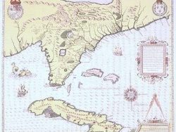
Florida, Cuba, and the Bahamas 1564 – Souvenir Series
$16.00 Add to cart -
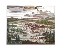
Fort Caroline, Florida 1671 – Souvenir Series
$16.00 Add to cart -
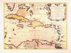
West Indies 1688 – Souvenir Series
$16.00 Add to cart -
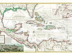
Caribbean 1715 – Souvenir Series
$16.00 Add to cart -
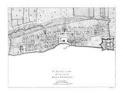
St. Augustine, Florida 1763
$32.50 Add to cart -
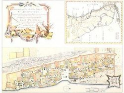
St. Augustine, Florida 1764 – Museum Series
$37.50 Add to cart